The accompanying map is from around the mid 1800's before the farm was built and some of the fields were altered in shape following developments in Feckenham Road and upper Marlpit Lane, although generally everything else is correct ( I think!) I have noticed that some bits of the map and positioning of various features are not exactly in their correct places (artistic licence, but hey ho, a mine of useful information). It is interesting to note the farm duck pond being shown in its rightful place, and the long since gone Brickworks in Marlpit Lane. Today all bricks are delivered on a big lorry. In those days in order to build a house or houses, one first set up a brickworks, dug the local clay, made a furnace and produced your bricks. Hence many houses were built in clumps, not just solitary dwellings. The area is mainly marl, ideal for brick making, and hence the name 'Marlpit'. Legend has it that cart loads of marl were transported from the area to Tardebigge to line the new Birmingham to Worcester canal, Bromsgrove side being mostly sandy and totally unsuitable. The clay pit shown in field 110 was in fact in field 97 in my youth, as we used to go sledging both into it, and also down the slope of the field.
Fields 110 and 111 were combined at sometime, probably due to the extensive grounds of the bungalow called The Spinneys, which occupied a large square portion of field 110 in the bottom left hand corner, extending halfway up the remaining portion of the lane. During the late forties the 'Ingleback' family lived there, moving in the early fifties to Bentley I believe. My mothers house was number 42 Feckenham Road, built around 1919 in the bottom left hand corner of field 111, and not shown on this map, as are the houses at the start of Marlpit. The old farm house from whence the Old English Barn was moved is shown as the last building in Feckenham Road before Marlpit Lane -
The dwellings shown in Rushybottom eventually became derelict, the first inhabited by the local 'carter' Mr Russell, and the latter later on inhabited by Mrs Bryant and her son. Mr Russell moved up to the last cottage down Marlpit lane on the left where I believe he eventually popped his iron shod clogs.
The area of the farm was around 85 acres as I remember of mixed arable, dairy and livestock. This was the normal make up of farms such as this, up to the periods around the sixties when hedges and trees were being grubbed out to make larger fields to suit the more powerful mechanised machinery that was appearing with ever more frequency. The old eight foot wide wooden gates were fast being replaced with ten foot metal gates to give clearance to the eight foot cutter bar on the modern combine harvester. Whilst Ray Harper was farming the land, the widest thing to pass his gates was the old 'Sunshine' binder, which folded up sideways to around the same width as the old tractors.
The main cereal crop grown was oats, which was cut using the binder, and then the sheaves were stooked in eights to dry for a few days in the sun. Ricks were made in the field numbered 95 along the bottom hedge, to be thrashed in the winter by outside contractors, the straw being likewise baled at the same time. Oats were grown in the fields numbered 144, 145 152, 155 and 201. In the latter years field number 87 was ploughed and put down to wheat. The other fields were either grazing pasture or left as hay fields. Ray Harpers first unsuccessful attempt at making silage happened in field 159 in a depression adjacent to Downsell Wood.
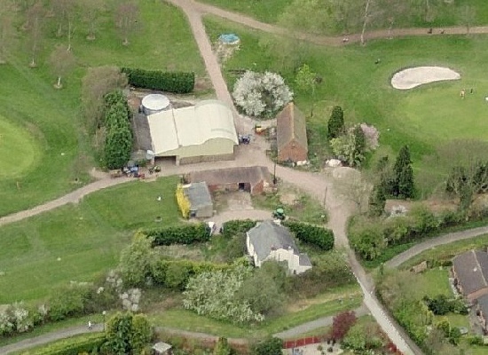
The field numbered 160 became the eventual site of the farm house and buildings.